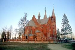
Daugavpils, the second big city in Latvia after Riga, is an independent structural unit. The total population number is 1522,5 , out of which Latvians 17,7%, Russians 54%, Poles 14,9%.
As to communication there are 5 railway lines and a numerous number of auto roads. There is also an airport in Daugavpils and a moorage for river vessels in Lači or Lociki in the direction to the north-east of the city.
In 1582 Daugavpils was granted a city status.
The city changed its name many times: Dinaburg (1275-1893, with interruptions), Borisoglebsk (1656-1667), Dvinsk (1893-1920), Daugavpils (from 1920).
The major role in the development of the city of Daugavpils played the fortress built in the beginning of 19th century. In the second half of 19th century due to the railroad lines and highways construction the city became a trade centre of the north-western part of Russian Empire.
Daugavpils district
Daugavpils region borders with Lithuania, Belorussia, Krāslava, Preiļi and Jēkabpils. There are 24 small rural areas and 2 towns (Ilūkste, Subate) with total number of population 40588 in the region.
The area of the territory is 2525 km2.
The Daugava river meanders throughout all the territory of the region, making 10 loops from Kraslava to Krauja and running calmly from Liksna and Nicgale, and then it flows into the Baltic sea dividing the region into two parts which developed politically and ethnographically independently.
Augšzeme, or the land of sels, is situated on the left bank of Daugava, Latgale – on the right.
There 194 lakes in Daugavpils region
Average air temperature:
- Annually +6,40 C
- In January –6,6 C
- In July +17,6 C
